Dragoness Eclectic (![[personal profile]](https://www.dreamwidth.org/img/silk/identity/user.png) dragoness_e) wrote2007-07-15 02:26 pm
dragoness_e) wrote2007-07-15 02:26 pm
Entry tags:
Painted Desert Pictures, part 2
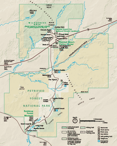
More pictures from Arizona. As previously recounted, after passing through a corner of the Navajo Nation, I detoured through the Petrified Forest National Park. (Map).
Referring to the map, the Painted Desert pictures on this page were all taken in the north section of the loop, around Tiwa Point and Kachina Point, and a few just hanging off the side of the road. Later posts will have pictures from areas south of I-40.
Google satellite map of the area I photographed

As you can see above, the northern loop of road loops around a highland area that overlooks some very rugged valleys. Most of the pictures below are looking into those valleys.
The highlands were rather lush desert grasses

Painted Desert from Tiwa Point


Hanging out the car window shot of the Painted Desert

(To Be Continued)
Referring to the map, the Painted Desert pictures on this page were all taken in the north section of the loop, around Tiwa Point and Kachina Point, and a few just hanging off the side of the road. Later posts will have pictures from areas south of I-40.
Google satellite map of the area I photographed
As you can see above, the northern loop of road loops around a highland area that overlooks some very rugged valleys. Most of the pictures below are looking into those valleys.
The highlands were rather lush desert grasses
Painted Desert from Tiwa Point
Hanging out the car window shot of the Painted Desert
(To Be Continued)